
In the Middle Ages, maritime transport was highly developed, and what guided ships across the vast ocean were the compass and nautical charts. Today, the author would like to introduce the compass and map of the drone world: the RTK positioning system, short for Real-Time Kinematic.
When it comes to positioning systems, the first things that come to mind are usually GPS or the BeiDou system. So where does RTK come from? Is it the same kind of system as GPS?
In fact, the Global Positioning System, or GPS, that most people are familiar with is the satellite navigation system used by the United States. Other systems at the same level include China’s BeiDou Navigation Satellite System (BDS), Russia’s GLONASS, and the European Union’s Galileo positioning system. All of these fall under the broader category of Global Navigation Satellite Systems, or GNSS.
GNSS satellite signals can achieve positioning accuracy within about 10 meters, making them highly practical navigation and positioning systems. However, what if higher precision is required, such as accuracy within 5 meters or even down to the centimeter level? This is where the RTK positioning system comes into play.
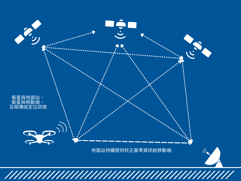
Real Time Kinematics Positioning System
The RTK positioning system is based on GPS technology. It works by setting up a base station with known coordinates on the ground and using the GPS carrier signals captured by the ground base station to reduce positioning errors for the drone. With this technology, positioning accuracy errors can even be reduced to the millimeter level.
RTK consists of two sets of signal receivers: a ground/base station, known as the Base, and a mobile receiver, known as the Rover. Before the drone takes off, GPS is first used to determine the position of the ground station. The mobile receiver is then installed on the drone to perform real-time corrections, achieving positioning errors at the millimeter level. However, the effective range of this technology is within a radius of 10 kilometers.
If there is a need to operate beyond a radius of 10 kilometers, the government’s e-GNSS system may be considered. The difference between e-GNSS and the RTK positioning system lies in whether a ground base station is required.
The RTK positioning system requires the setup of a ground base station to provide reference signals, while e-GNSS uses a virtual reference station. Instead of relying on a physical base station to generate reference signals, e-GNSS directly obtains government-provided correction signals through a mobile network.
However, using e-GNSS increases the positioning accuracy error to approximately within 10 centimeters. Users may choose between GNSS, RTK, or e-GNSS depending on their specific application requirements.

The RTK positioning system can be applied in scenarios that require high positioning accuracy, such as autonomous driving, autonomous robots, agricultural automation, wearable devices, and shared bicycles. For applications beyond drones, please feel free to contact our company for product consultation.